
Pinpoint anything without GPS.
Turn a UAV's video into ground coordinates, with no GPS and no metadata, even where the signal is jammed.
GPS is the first thing they take.
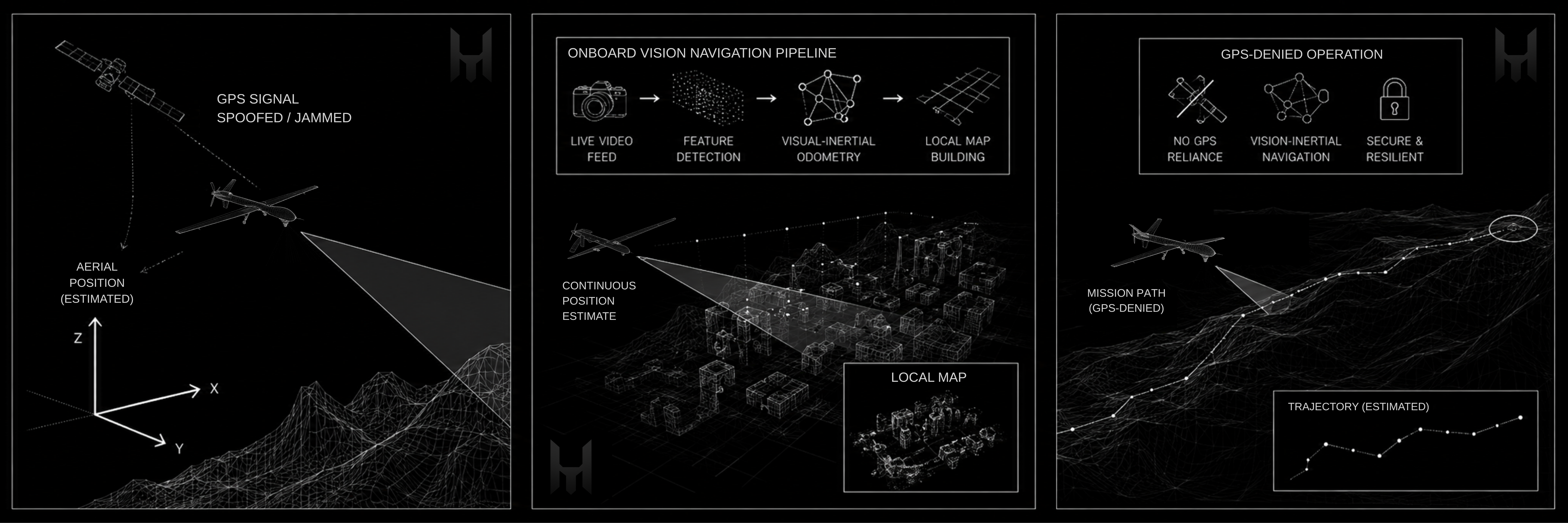
Jamming and spoofing are cheap, widespread, and the opening move in any contested airspace. The UAV keeps flying, but its video turns eyes-only: an operator can see a vehicle, a person, a building, yet cannot say where it is. Hisar reads position from the picture instead of a satellite signal, so a denied feed still produces map-grade intelligence.
Frame → coordinate
Point at anything in the feed and read its ground coordinate, no metadata.
No GPS
Position is read from the image alone, with no satellite-navigation signal in the loop.
Through jamming
GPS jamming and spoofing have no signal to attack, so coordinates keep coming.
It sees the ground
Works from the UAV's existing camera feed, no GPS and no beacon.
It knows where
Hisar reads what the camera sees against its own geospatial intelligence to fix the position.
It returns the coordinate
Point at anything in frame and get its ground coordinate, ready to report or act on.
Mission review
Recorded or uploaded footage, georeferenced after the flight, in a review workspace at the analyst's desk.
Ground station
Live coordinate extraction during flight, on the operator's own machine beside the controller.
Air-gapped build
A sealed, offline deployment for denied environments, area pre-loaded, nothing phoning home.
Where GPS gets jammed, we step in.
Coordinate extraction from UAV video, with no GPS, is in development. Tell us the area you operate in and we will keep you posted as it rolls out.